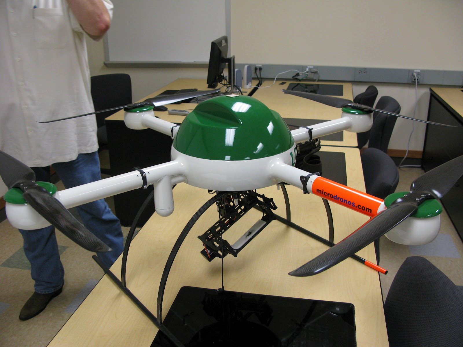
Thursday, July 19, 2012

Day 26,27,28 and 29
Dr. Rudi Thompson gives RET participants a tour of EESAT  Building

The atrium in the EESAT Building
This week we have been quite busy putting the finishing touches on our deliverables for our projects. We are required to submit 1. Poster 2. Research Paper 3. Presentation 4. Lesson Plans 5. TechFest Activity 6. Group Poster

On Day 29 we also took group photos wearing our RET shirts and profile shots as well.

Friday, July 13, 2012

Day 25
RET Participants, Dr. Acevedo, Dr. Hunter and visitors from Universidad Autonoma del Estado de Mexico
Today the RET group met with visitors from Mexico. Dr. Hunter has been doing some work with the Universidad Autonoma del Estado de Mexico and during their visit to the United States, he wanted to expose them to some of the work being done in the RET project. We talked with them about how their education system is designed in Mexico and shared how ours is designed in the U.S. We then discussed the similarities and differences as well as how we could possibly have a WebLab session with one of their middle or high schools.

Thursday, July 12, 2012

Day 23 & 24
Dr. Kuruvilla John presented on Air Quality

Dr. John gave a very enlightening presentation regarding some of his research in air quality studies. Dr. John presented numerous examples on how the equipment they have installed in the field has been able to correllate changes in air quality in certain geographical areas with current events.

Kim and I spent time working on documentation relating to our literature review and final paper. We also conferred with Dr. Bruce Hunter to discuss the arcGIS siftware installed on the systems in his lab in the EESAT building. Kim was able to install the arcGIS software on a lab computer after getting administrative permission granted from Jason. She was able too install the arcGIS explorer and we were then able to look at some of the data files and assign different colors to the files. Afterwards, the scale was used to measure distance and then convert the distance into equivalent carbon emissions. It turns out that there is a carbon footprint calculator on the epa.gov website that will calculate the carbon footprint for you if you entered the mpg of the vehicle used and distance.

Tuesday, July 10, 2012

Day 21 & 22

Kim and I met with Dr. Huang and Jason today to discuss data for the Rideshare project. We will continue to collect data from peers and try to convert the data to text format and then remove the needed sections and save back to .gpx format. We will then be able to look at trips of data and a better analysis can be made.

Dr. Bruce Hunter with GPS system

Our RET group attended a seminar on the main campus in the Environmental Science Building. The seminar was conducted by Dr. Bruce Hunter. The topic was Geographic Information Systems (GIS) .

Friday, July 6, 2012

Day 20 - WK 4


Lesson Plan Development day.  I have corrected all the suggestions that Sharon made and created an activity sheet lesson for the RC car.  Watched several videos to present the lesson concepts for teachers who are in flipped and PBL classrooms.  Got topofusion.com demo version put on UNT computers for us to try as a GIS program.  Looked online at EPA for carbon footprint lessons. Observed the young vultures outside our windows

Thursday, July 5, 2012

Day 19 WK-4

David Hunter - Presenter
After recovering from the July 4th festivities,  David Hunter provided a comprehensive presentation on Water Quality and some of the programs and research that is underway in Denton as well as other areas in the state of Texas. David did say schedule permitting he would be able to come to the schools and speak on his areas of specialty including weather.

Mr. Hunter is in the U.S. Navy, a certified meterologist and is currently enrolled in the graduate program at the University of North Texas.
Day 19 - WK 4

This morning I looked at the NY Times article on Ridesharing apps today.  It had most of the same ones we had been looking at.  Joyride was a new one, and it connects people through facebook, which is very interesting.  I also started updating my lesson plan with the suggestions Sharon gave me.  I was looking at the requirements and the area it would fit if I were to try and publish it on tryengineering.org.  We had a seminar in water quality presented by David Hunter I also looked at edmodo, a site which is a social media site for teachers, with lots of resource ideas to connect teachers and students online.  I researched and looked up literature articles on liability issues and casual carpooling, I want to find out what the social aspects of liability are.  I found a couple articles, one that had surveys of casual slugging in Houston, very interesting.

Tuesday, July 3, 2012

Day 17 WK-4
Quadcopter
Dr. Sam Atkinson and Dr. Thompson
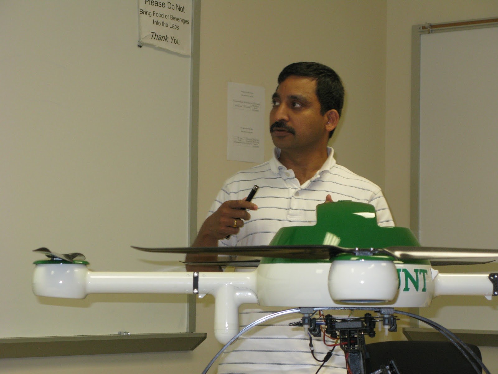
Dr. Namuduri - Presenter
Today the RET Team attended presentations from Dr. Sam Atkinson and Dr. Namuduri. Dr. Atkinson provided updates on some of the research he and his group are engaged in at the university. He brought the quadcopter and showed a video clip to demonstrate some of the capability the drone provides his research team.

Dr. Namuduri provided updates on research he and his team are doing as well. Dr. Namuduri's research involves autonomous systems. These robots should have the capability to operate alone, make decisions, and interact with others.

Kim was able to locate a software package called Topofusion that will allow overlaying of trajectories with GPS data. Each file could be represented by a different color therefore making common routes very clear on  Google maps. The trial version of this software is free and can be used without expiration if you can stand the watermark logo that's posted.


Monday, July 2, 2012

Day 16 WK-4
Dr. Acevedo -Facilitator

Donn Arnold - Presenter

Jennifer Williams - Presenter

Dr. Wasson - Presenter
The RET group attended a presentation concerning WebLab. WebLab is a program Donn Arnold and Jennifer Williams have been working on with the guidance of Dr. Acevedo and Dr. Wasson. The WebLab program is designed to reach out to middle and high school students and inform them about engineering activities and careers by bringing video technology into their classrooms with presentations from college students about projects they are currently involved in developing. The presentations are interactive where students can see and talk to the presenters and vice versa.


Day 16 - WK 3

This morning came in and began looking at some of the reference resources that Dr Wasson suggested for societal issues related to technology and ride-sharing.
Took an online carbon footprint calculator designed for high school students.  Very good site, a little lengthy but it has really good application to students daily lives.  http://footprint.stanford.edu/calculate.html  this site is part of the International Carbon Footprint Student Challenge.  Students can compare their data to the US average, to other students around the globe in real-time and to other countries averages and look at ways to re-calculate and reduce their own.  I am going to add this component to our lesson plan as an introductory awareness activity to the big picture of global climate change and one planet.  Spent the afternoon looking at different GIS applications, trying to learn how to overlay different GPS data and maps to get one visual image.  I am going to try GRASS GIS, it is a free program and seems to be pretty flexible.  I also am looking at arcGIS, but it is expensive to have the entire software.
Day 15 WK-3
Karl Gscheidle, Elizabeth Sink - Presenters

Zac Bunn, Jose Guerrero, Lori Wolf - Presenters

Bruce Hunter - Visitor


Friday was mid-term presentation day for each of the RET groups. All morning was consumed with group presentations.